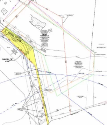
Bruce Point Road survey map
Survey map to show the boundaries of the end of the Bruce Point Road.
Survey map to show the boundaries of the end of the Bruce Point Road.

Surveyors have confirmed the boundaries of the Bruce Point Road and the final survey plan establishes permanent public access to Boughton Island. Significant evidence was gathered from various sources including historical records, land title research, surveys, aerial photography...
The wharf at Basin Head is closed temporarily for safety reasons. While preparing for dredging the channel, bridge engineers noted structural damage beneath the wharf and deemed it currently unsafe for public access. “Safety is the first priority and we will fix this issue now...
Surveyors have confirmed the boundaries of the Bruce Point Road and the final survey plan establishes permanent public access to Boughton Island. “This road has been used for shore access since 1935 and our work has confirmed that this is a public road and will remain open to the...